Strava introduced their heatmaps and their
Strava Slide tool at the Washington DC conference of the OSM US community
SotM-US in the spring. I had a quick look at the time and it seemed interesting, but there was little data in areas which I map.
A question came up recently regarding how accurate the Strava heatmaps are for mapping routes on OpenStreetMap, particularly in wooded areas. This prompted me to have another look at the data.
It happens that I have made a lot of traces across two paths on an open playing field (an area sufficiently unobstructed that it is used periodically for calibrating and testing professional grade GPS equipment). A short distance from these two paths is NCN 6, a heavily used national cycle route. It was therefore very easy to grab some screen grabs of Strava and OSM data:
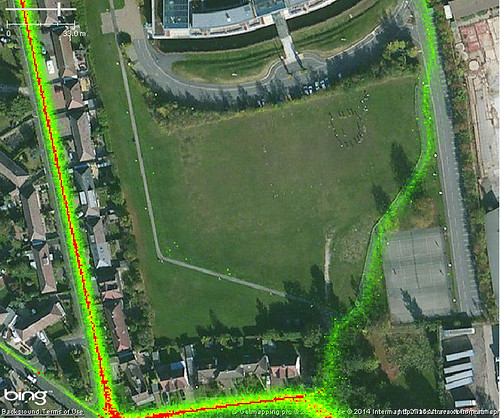 |
Strava Cycling Heat Map
(NCN 6 on left, university cycle paths centre & right) |
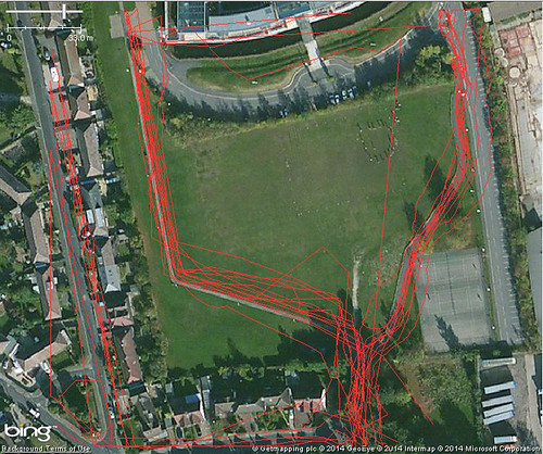 |
The same area showing traces which have been uploaded to OpenStreetMap
(probably mainly by me) |
