Thursday 18 September 2014

OpenStreetMap at the UK Open Addresses Sympoosium

I attended the Open Addresses Symposium organised by Jeni Tennison of the Open Data Institute last month. This brought together a host of people and organisations interested in having an open alternative to the Postcode Address File (PAF).

Somewhat foolishly I'd suggested to Harry Wood that I might speak about addresses on OpenStreetMap.

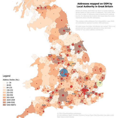
Addresses mapped on OpenStreetMap in Britain
Density of address mapping in (southern) Britain on OpenStreetMap by local authority
(Northern Scotland not shown because little data, full map)
See text on map for full explanation.
I was glad to see that my talk was relatively late on in the day: the audience were unfamiliar and many of them came from large organisations., so I appreciated the chance to get an impression of them.


Tuesday 2 September 2014

Woodland Cartography

This is an expanded version of my talk at sotm-eu:


I start by seeking inspiration from the many ways in which woods and trees have been shown on maps in the past, and then consider what elements we may want for OSM data, and how we might depict such elements.

Monday 1 September 2014

Contributing to the Lesotho Mapathon

At the start of August I appeared in the OpenStreetMap stats for users adding most data in a day. This was the first time in ages that I've made enough edits to appear. The reason: I've been contributing this past week to a mapathon to map as much of Lesotho as possible. This has been co-ordinated by Irish OSM contributors, some of whom will travel to Lesotho early next year.
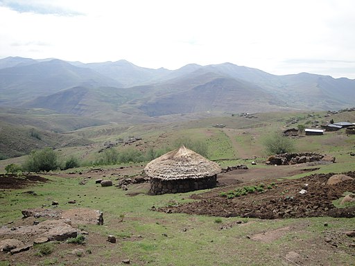
View from Lesotho village (5297237744)
A village in Mokhotlong District.
This is S of the area I have mapped, but looks similar on aerial photos.
Source: Wikimedia Commons.
The co-ordination makes use of the HOT Task Manager: a piece of software which has distant origins in something, long gone, called QualityStreetMap.

I've use the Task Manager fairly rarely, but development over the past year has added one feature which for makes it much easier to use: the creation of a bounding box in the JOSM editor. It is now much simpler to see the area one has undertaken to map. This in turn is important in reducing editing conflicts and redundant work.